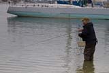
Bernard wrote:First off, apologies for my report being sort of bitter sweet but that's southern California trout for you right?
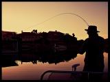
I love how the conversation has morphed into the deeper reaches of the WF. I have visited Devils Canyon numerous times both from the 2 as well as from Cogswell. I'd say my first time there was around 1992. I have also fished the fork further to the west below Red Box gap. During better times, I would get protective and suggest that this conversation be moved to the delicate category but the drought years and the Bobcat fire hammered the heck out of these regions. Historically, as maybe you can sense, they all fished incredibly well and I fondly recall some of the dam keepers boasting of sizable fish from the actual lake. As for the legality of fishing that lake, it seems to depend who you ask but intercepting migrating fish in spring and targeting resident fish is/was always easier for me. Again ... sigh .... during better times. For those still curious, note that the canyon Devils Canyon is actually divided, so to speak, by a waterfall. It represents a migrational barrier for fish coming out of Cogswell. To reach the pool at the base of these falls is an insane amount of work regardless if whether or not you come from above or below. Poison oak is just part of it. Rattlers galore and large mammals busting through the brush are/were part of most treks I have done here. One interesting thing about Cogswell is that unlike the San Gabriel Reservoir, it has no warm water species. It does have a robust population of chubs though. I think this contributed to the … ahem … "healthy" trout in that region. Devils Canyon unlike the other fork further to the west comes out of rougher terrain and a deeper gradient and as a result has deeper pools and more potential to protect fish even during hot and dry spells. The last time I went there was probably 2019 and some of the best pools were heavily silted in. I am afraid to take a look at Cogswell at this point but maybe in the years to come, I will go back up there. I have witnessed fish populations boom and bust almost cyclically and always as a result of a setback such as fire, mudslides, and/or drought .... Should anyone else venture that far report would be so cool. Be it the deep reaches of the SG system or elsewhere, I am cautiously optimistic that these rains will help some local trout populations a little. We know they are tough! Tight lines!
- Bernard
No apologies needed….thanks for filling in some of the WF gaps.
The WF for me was always a second, third, or even fourth choice when heading into the San Gabs. If the EF or Cattle Creek were running high and muddy, I’d drive up and fish the NF above the big cabin stretch. If the NF was blown out I’d walk the WF into Bear Creek and head upstream. If all were blown out, there was always the controlled flow of the WF, but it was always my last choice because of the constant road traffic, human presence, graffiti and litter everywhere. I also always seemed to catch larger fish (although not quite as colorful) on the other tribs.
Hopefully the rain you’re getting will recharge the aquifers and springs and bring them all back to a fishable status once again.
…..many fond memories still exist for me of my beloved San Gabriels.
Regards,
Jeff